
Roof Dimensions
Indicative roof lengths, widths and other relevant dimensions to support preliminary project planning and assessment.
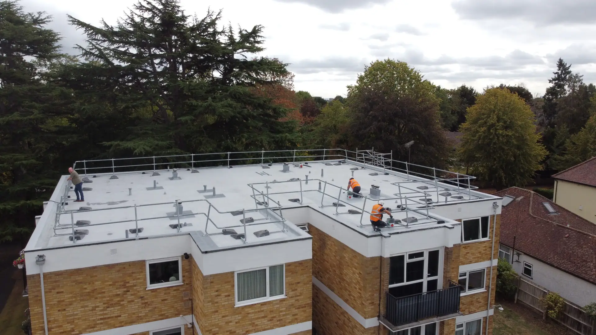
Understand the size, layout and dimensions of your commercial roof. Our measured roof survey services provide aerial mapping and dimensional information to support roofing refurbishment, replacement, maintenance and future project planning.
Reliable dimensional information is an important part of planning commercial roofing projects, estimating material requirements and establishing the scope of work.
Large industrial and commercial roofs can be difficult to measure using traditional methods, particularly where access is restricted or the roofing system is extensive or fragile.
Measured roof surveys use appropriate measurement techniques, aerial photography and mapping information to develop an understanding of roof dimensions, roof sections and approximate surface areas.
Where suitable, aerial photogrammetry can assist with the production of scaled imagery, dimensional information and roof layout plans.
Elite Waterproofing combines practical roofing knowledge with appropriate survey methods to help clients establish the information required for their roofing projects.
Discuss Your ProjectThe survey deliverables depend on the property, the measurement methods available and the accuracy requirements of the proposed project.
Indicative roof lengths, widths and other relevant dimensions to support preliminary project planning and assessment.
Estimated roof plan areas and, where suitable geometry is available, roof surface area calculations accounting for roof pitch.
Overhead imagery and mapping information to document the layout of roof sections, building boundaries and visible features.
Identification of distinct roofing areas, roof levels and adjoining sections to assist phased maintenance or refurbishment planning.
Documentation of visible rooflights, vents, plant, roof penetrations and other relevant roof features.
Indicative linear measurements of suitable visible roof edges, ridges and gutter runs where included in the agreed survey scope.
Information about roof layout, pitch and relative levels where the survey methodology supports these measurements.
Preliminary measurement information to support material quantity estimates and the development of roofing project budgets.
Relevant plans, photographs and measurement schedules presented in the agreed format for reference and project planning.
A measured roof plan can provide a useful overview of the roofing system, helping clients understand roof dimensions, individual sections and the location of key components.
For larger industrial buildings, roof areas may be divided into separate sections to assist measurement, reporting and the preparation of project proposals.
Where appropriate, roof plans can identify ridge lines, gutter runs, rooflights and other visible features relevant to the proposed roofing work.
The information can then be considered alongside roof condition observations and the requirements of the proposed repair, refurbishment or replacement.
Request a Roof Measurement SurveyPhotogrammetry is a measurement technique that uses overlapping photographs to reconstruct the shape and position of visible surfaces.
During a suitable aerial mapping survey, a series of photographs is captured across the roof from planned positions, with sufficient overlap between adjacent images.
Specialist processing software identifies common features within the photographs and uses their relative positions to reconstruct spatial information.
Depending on the equipment, capture methodology and available reference measurements, this information can support the creation of scaled imagery, roof plans and three-dimensional surface models.
Where higher measurement accuracy is required, appropriate positioning equipment, surveyed control points and independent accuracy checks may be needed.
Aerial mapping can therefore provide useful dimensional information for commercial roofing projects without requiring direct physical measurement of every accessible roof section.

Multiple aerial photographs can be processed into a geometrically corrected composite image, supporting suitable plan measurements and roof layout documentation.
Photogrammetric processing can reconstruct visible surface geometry, supporting the assessment of roof shape, pitch and relative levels where appropriate.
Appropriate positioning information, reference measurements and survey control can improve the reliability of derived measurements.
Use our simple calculator to obtain an indicative roof area based on known horizontal dimensions and roof pitch.
Roof plan area is the horizontal area of the roof when viewed from directly above.
Where a roof is pitched, the actual sloping surface area will be greater than its horizontal plan area.
The calculator provides a preliminary estimate for a rectangular roof with a consistent pitch, helping illustrate the difference between plan area and roof surface area.
For complex roofing systems, multiple roof pitches, changes in level and irregular roof layouts, a more detailed measured assessment will be required.
This calculator is intended for preliminary guidance only and is not a substitute for a measured roof survey or final material take-off.
Enter the horizontal roof length, horizontal width and pitch.
Measured roof information can support the development of roofing proposals across a range of commercial and industrial applications.
Roof dimensions and layout information can assist preliminary calculations of roofing material quantities, roof sections and the overall replacement scope.
Detailed specification and final measurements are required before materials are ordered.
Explore Roof ReplacementMeasured surveys can support the development of refurbishment proposals, including indicative treatment areas, roof coatings and sections requiring remedial attention.
Measurements can be considered alongside condition survey findings.
Explore Roof RefurbishmentRoof geometry and dimensions can assist initial planning for overcladding projects, including proposed roofing areas and associated details.
Structural assessment and detailed design remain important parts of project specification.
Explore OvercladdingRoof plans may assist preliminary identification of available roof space, roof orientation, obstructions and potential installation areas.
Solar proposals require appropriate structural, electrical and installation assessments.
Explore Solar InstallationIndicative gutter lengths and drainage layouts can support preliminary planning for gutter replacement and associated roofing works.
Gutter profiles, capacity and outlet details may require closer physical inspection.
Explore Gutter ReplacementAerial roof mapping can assist identification of visible rooflight positions, quantities and indicative dimensions.
Final rooflight specifications require confirmation of sizes, profiles and existing roofing construction.
Explore Rooflight ReplacementDifferent roofing projects require different levels of measurement detail and dimensional accuracy.
Preliminary roof area estimates may be suitable for initial project budgets, maintenance planning and early feasibility assessments.
More detailed project specifications, fabrication and material procurement may require higher accuracy, independent measurement checks and physical verification.
The level of accuracy required should be established before the survey is undertaken, allowing appropriate measurement techniques to be selected.
Aerial measurement is a valuable planning tool, but it should not be treated as a replacement for all forms of detailed construction surveying.
The horizontal area of a pitched roof is smaller than its actual sloping surface area. Appropriate geometry must be considered when calculating roofing material requirements.
Measurement reliability depends on camera calibration, positioning information, image resolution, processing and any survey control used during data capture.
Complex roof forms, obstructions, reflective materials and concealed components may affect the information that can be obtained remotely.
Roof area does not directly establish the quantity of materials required. Overlaps, sheet lengths, cutting, waste and installation requirements must also be considered.
Dimensions required for fabrication, construction or final procurement must be verified to the appropriate project-specific tolerances.
A measured roof survey does not establish structural integrity, load-bearing capacity or suitability for additional loading. Separate engineering assessment may be required.
Each survey is planned around the building, the roofing system and the information required by the client.
We establish the property location, roof type, proposed project and the measurements or mapping information required.
Appropriate measurement methods are considered alongside access, site suitability, accuracy requirements and flight restrictions.
Relevant photographs, measurements and reference information are recorded across the agreed roofing areas.
The survey information is processed and reviewed, with agreed plans, measurements and limitations presented to the client.
Measured roof information can be combined with visual inspections, condition reports and specialist thermal investigations to support wider roofing project decisions.
A measured roof survey is an assessment of relevant roof dimensions, layout, areas and visible features.
Depending on the survey scope, the information can be presented as annotated imagery, roof plans, measurement schedules or other agreed survey deliverables.
Drone-based measurement can provide useful dimensional information when appropriate equipment, image capture, positioning and processing methods are used.
The achievable accuracy depends on the complete survey methodology, roof characteristics and available reference or control measurements.
Required accuracy should be agreed before the survey is undertaken.
Roof plan area is the horizontal area of the roof as viewed directly from above.
Roof surface area accounts for the actual roof slopes. For a uniform pitched roof, surface area is calculated by dividing the horizontal plan area by the cosine of the pitch angle.
Complex roofing systems may require separate calculations for each roof section.
Measured survey information can support preliminary material quantity assessments and the development of project budgets.
Final material ordering requires appropriate verification of dimensions, roofing profiles, overlaps, fixing details, cutting allowances and the proposed installation methodology.
Where visible and included in the agreed survey scope, aerial information may assist with indicative measurements of gutter runs, rooflights, ridges and other roof features.
More detailed component specifications may require direct physical measurement or additional inspection.
An orthomosaic is a composite image produced from multiple overlapping photographs that have been processed to correct relevant geometric distortions.
A suitably produced and scaled orthomosaic can support roof mapping, plan measurements and the documentation of visible roofing features.
Suitable aerial photogrammetry can be used to reconstruct three-dimensional information about visible roof surfaces.
The suitability of a 3D model depends on the roof geometry, image coverage, survey methodology and the level of detail required. Model availability should be agreed as part of the survey scope.
Measured roof surveys can use a variety of techniques, including conventional measurements, aerial photogrammetry and specialist laser scanning systems.
Photogrammetry uses overlapping photographs to reconstruct spatial information, while surveying LiDAR uses laser measurements to create spatial point clouds.
The appropriate method depends on the accuracy, detail and survey deliverables required. Drone obstacle avoidance sensors should not be confused with dedicated surveying LiDAR equipment.
Yes. Dimensional information and aerial mapping can be considered alongside roof condition observations and photographic defect records.
This can help establish the approximate locations and scale of observed roofing concerns, supporting the development of maintenance or refurbishment proposals.
Pricing depends on property location, roof size, geometry, required measurement accuracy, access and the agreed survey deliverables.
A straightforward roof area assessment will generally have a different scope from detailed aerial mapping of a large industrial estate.
Contact Elite Waterproofing with your property details and project requirements for a tailored quotation.
Whether you are planning roof replacement, refurbishment, overcladding, solar installation or future maintenance, contact Elite Waterproofing to discuss your roof measurements and survey requirements.